Search for articles or browse our knowledge portal by topic.
Utility Relocation Field Inspections
This article summarizes the 3WH training webinar on Utility Relocation Field Inspections. It covers tools and techniques that can be used to conduct inspections of utility construction throughout project development.

Utility construction work is inspected by KYTC and the utility company. However, KYTC and the utility company have different goals when inspecting facilities (see figure below).

KYTC is responsible for tracking and inspecting the progress of all utility and rail work. The District Utility Supervisor (US) or Utility Agent (UA) performs these field verification activities.
Before utility construction begins the US or UA should:
- Review the agreement to understand charges that are eligible for compensation
- Review the latest plans to familiarize themselves with the location and construction limits
- Notify appropriate Cabinet officials of any discrepancy
- Meet regularly with the utility company representative
During utility construction the US or UA should:
- Review utility company reports
- Inspect the site(s)
- Record entries in a Utility Progress Report
Critical information that must be collected during the inspection includes:
- Date
- Time
- Location of construction work
- Latitude/Longitude
- Percent complete
Other helpful information that should be collected during the inspection includes:
- Photographs
- Composition of the crew
- Vehicles and equipment
- Type of work
- Location of facility in relationship to road design elements
- Recently delivered materials and their condition
The following items should be observed and documented to ensure compliance with the design:
- Traffic control and safe worksite
- Lateral placement of utilities
- Depth of underground facility installations and structures
- Sizes and types of materials
Other important elements that should be observed during the inspection include:
- Note potential conflict locations
- Review backfill placement for adherence to Cabinet specs
- Report locations of bad soil conditions
- Ensure out-of-service facilities are safeloaded or removed
- Note removal of materials
- Note salvaged items
- Review the proximity of utilities to road design
As stated in the Utilities and Rails Manual, “Within limits of highway construction, all utility work is subject to inspection to ensure compliance with the applicable permit or agreement” (UR-1306). Utilities are inspected for the following reasons:
- Ensure compliance with policy and agreement
- Ensure safe operations
- Document progress and schedule
- Document location
FHWA also requires utility inspections. Its utility program guide Utility Relocation and Accommodation on Federal-Aid Highway Projects, states: “It is essential that State inspectors verify all reimbursable utility work that has been accomplished.” The guide goes on to say that “When the utility is to be reimbursed based upon the actual cost incurred under the force account payment method, the State, in particular, needs to have a daily inspection record that can be used to verify billings for labor, materials, and major items of equipment used by the utility to complete the work.”
Utility inspections can be recorded in Kentucky Utilities & Rails Tracking System (KURTS) and KURTS Mobile. The KURTS utility inspection application system:
- Manages utility coordination by project
- Contains KYTC’s Utility Coordination Matrix
- Records utility relocation inspections
KURTS Mobile is a mapping application available for field data collection of:
- Utility conflicts
- Utility relocation inspections
In KURTS, utility inspection information is located under the Construction tab. Once users select this tab, they can view utility inspection information for each facility on the project. After selecting a particular facility, a screen showing the inspection information will pop up that maps inspection data as shown below.
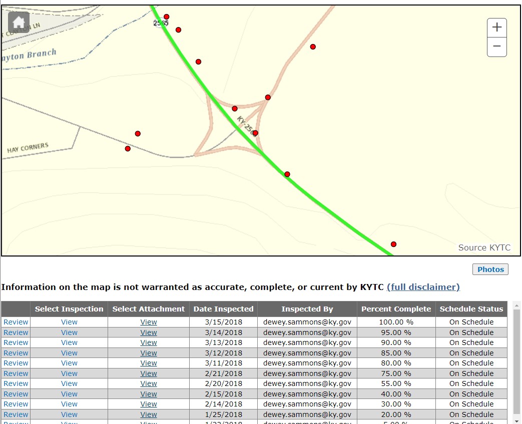
The inspection table underneath the map indicates the progress of work on individual facilities. Selecting Reviewfor one of the inspection rows opens an interface that contains information on the inspection broken down into six sections:
- Project information
- Location information
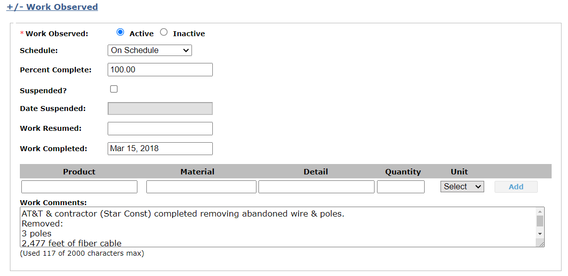
- Work observed
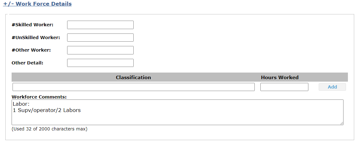
- Work force details
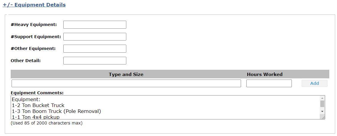
- Equipment details
- Materials removed
Project Information Section

Location Information Section
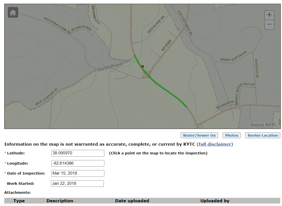
Work Observed Section
Work Force Details Section
Equipment Details Section
Material Removed Section

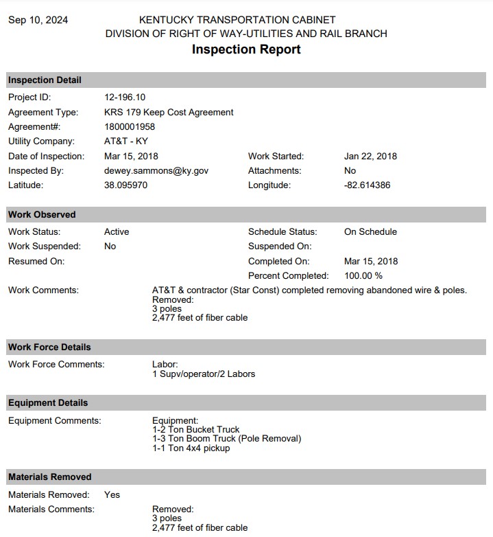
Alternatively, users can view an inspection report that summarizes the above information for individual inspections by clicking the view link under the Site Inspection column.
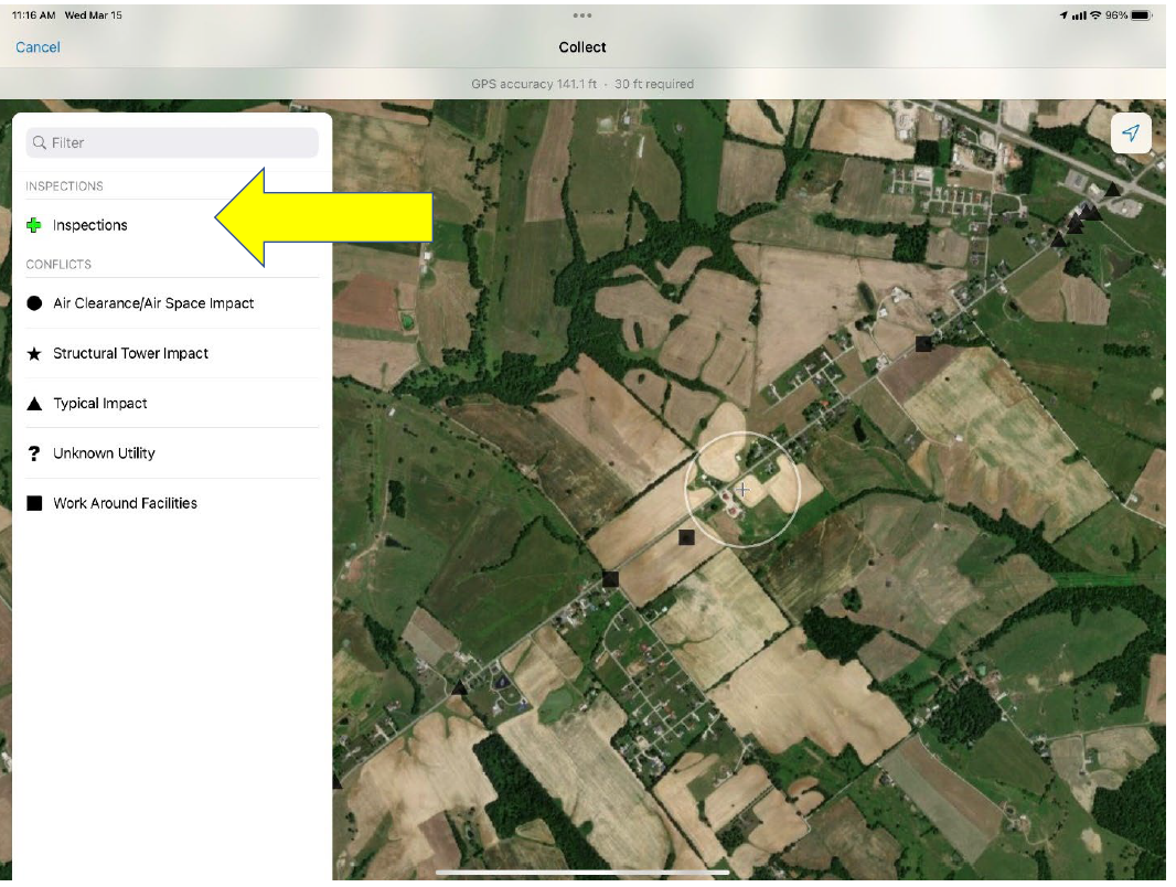
Users can employ KURTS Mobile in the field to record utility field inspection data by clicking the +Inspectionsbutton in the app as shown below. The information entered is the same as what was discussed in the previous section. However, it is organized differently in the KURTS Mobile application.
The KURTS Mobile utility inspection application has the following features:
- Uses ArcGIS Field Maps
- Can be used on any iOS or Android device
- IT grants users access and assigns login information, after which the user downloads the free app and logs in
- Instantly syncs with the cloud (if cell service is available) or can be downloaded to work offline and synced once back within wifi or cell range
- Records data such as:
- Date
- Project number
- Work status and percent complete
- Workers
- Additional comments
- Users can add as many photos as necessary
Data entry locations are symbolized with a plus sign in the KURTS Mobile app, as shown below.
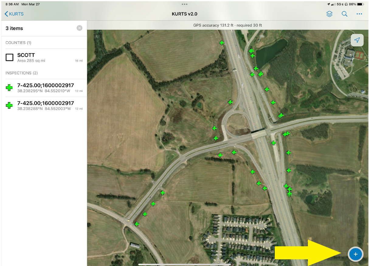
To enter inspection data in KURTS Mobile click the + button in the screen’s bottom-right corner. Information that can be entered while out in the field using KURTS Mobile is listed below. Items with an asterisk are required:
- Location*
- Progress*
- Status*
- Date*
- Approximate % complete*
- Photos
- Crews and equipment
- Type of work
- Materials
- Depth
- Size
- Potential conflicts
- Backfill
- Removed materials
- Potential salvage value
Red Flag
Training on KURTS and KURTS Mobile is available by contacting:
- KURTS
- Jennifer McCleve
- jennifer.mccleve@ky.gov
- KURTS Mobile
- Allen Rust
- allen.rust@ky.gov
