Search for articles or browse our knowledge portal by topic.
Subsurface Utility Engineering (SUE)
Underground utility facilities present unique problems because their location is not readily apparent aboveground. Subsurface Utility Engineering (SUE) lets project managers accurately locate and plan for the presence of underground utilities to avoid costly and/or unexpected relocations that can delay highway projects. It can generate considerable economic savings. Based on project data from four states, Lew (2000) found that for every $1.00 spent on SUE, state transportation agencies realized $4.62 in savings. The study also concluded that proper and systematic adoption of SUE would result in national savings of at least $1 billion per year (roughly $1.8 billion in 2023 dollars).
KTYC’s roadway design and utility coordination policies strive avoid utility conflict. If this is not possible, the goal is to minimize the effects of a conflict. Where minimization is not feasible, KYTC will mitigate the conflict. A successful utility coordination process demands robust coordination with utility companies to identify and locate existing facilities within project corridors. The Cabinet relies on SUE to determine the location of underground features so they can be avoided, or to minimize conflicts when avoidance is not possible.
The American Society of Civil Engineers (ASCE) Standard Guidelines for the Collection and Depiction of Existing Subsurface Utility Data (CI/ASCE 38-02) is KYTC’s primary guidance document for the SUE process. The Cabinet’s utility coordination policies are discussed in the following manuals:
- KYTC Utilities and Rails Guidance Manual
- Section UR-506 Subsurface Utility Engineering (SUE)
- Exhibit UR-9004 Design Memorandum 12-4 for Subsurface Utility Engineering
- KYTC Highway Design Manual
- HD-202.3.9 Utilities
- HD-203.7.3 Utility Coordination & Subsurface Utility Information
- HD 204.5 Subsurface Utility Information & Continued Coordination
- HD-304 Utility Location
Utility companies that could be impacted by the project should be contacted in the early stages of project development to gather information on their facility locations and inform them of the project scope.
The District Utility Supervisor can assist with early coordination because they have established relationships with local utility companies and are experienced interacting with them directly. They may also have knowledge about the location of facilities along the project corridor.
Other sources of information on underground features along the project corridor include:
- KY 811 (see below)
- Utility Company Mapping
- As-Built Highway Plans
- Kentucky Infrastructure Authority (KIA) Wastewater and Water Infrastructure Mapping
- Kentucky Public Service Commission GIS Site
Coordinating with affected utilities should continue throughout a project’s life cycle. For more information see the HKP Articles:
The Underground Facility Damage Prevention Act of 1994 (hereafter referred to as The Act in this article) requires that before excavation begins (a) utilities with underground facilities be alerted to impending project work and (b) facilities must be located. The law defines terms according to which underground utilities are located for design, construction, and emergency projects. It also outlines the responsibilities of parties typically involved, including utility companies (operators), engineers, excavators, and protection notification centers (see Kentucky Revised Statutes (KRS) Chapter 367, Sections 367.4901-4917, for more information).
The Act established a Kentucky Contact Center, a nonprofit corporation with a membership made up of utility companies and other utility stakeholders whose primary purpose is to coordinate the collection of information on underground utility facilities. This call center is commonly referred to as Kentucky 811 (formerly known as Before You Dig (BUD)).

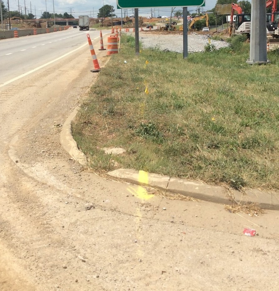
Kentucky 811 uses a ticket system to provide information and utility location markings for design and construction activities. Tickets are submitted by phone or through the Kentucky 811 website. Design tickets are submitted to obtain utility mapping services and establish location markings on the ground that represent the horizontal location of underground utilities. Location markings consist of paint, chalk, flags or stakes and follow the American Public Works Association (APWA) Uniform Color Code.
Once a design locate request is submitted, a utility operator has 10 full working days to provide the best available description of all utility facilities within the area of the proposed excavation. A normal locate request ticket is required before construction begins. It must be obtained two (2) days prior to construction.
The Act has guidelines for excavating near an underground facility. A tolerance zone is established around each utility and defined by “a strip of land at least four (4) feet wide but not wider than the width of the underground facility plus two (2) feet on either side of the outer limits of the facility.” Section 10 establishes procedures for working in the tolerance zone:
(10) When excavation or demolition is necessary within the tolerance zone, the excavator shall hand-dig or use nonintrusive means to avoid damage to the underground facility, except that mechanized equipment may be used:
(a) To remove the pavement or other manmade hard surface if used during the initial penetration only to the depth necessary and if an individual other than the equipment operator visually monitors the excavation activity;
(b) To remove indigenous rock if used during the initial penetration only to the extent necessary, if an individual other than the equipment operator visually monitors the excavation activity, and if the excavation is planned to avoid damage to the underground facility. However, if the underground facility contains flammable, toxic, corrosive, or hazardous products, the excavator shall notify the facility owner of the excavator’s intent prior to removing indigenous rock;
(c) To remove materials that are more than twelve (12) inches in any direction from the outer edge of the located facility if the excavator visually identifies the precise location of the underground facility or visually confirms that no facility is present within the depth of the excavation, if an individual other than the equipment operator visually monitors the excavation activity, and if the excavation is planned to avoid damage to the underground facility; and
(d) To place shores into an existing excavation or remove shores from an existing excavation.
Methods to locate facilities vary from highly advanced technologies to visually locating surface elements. More common techniques are described below.
6.1 Surface Geophysical Location Methods
Surface geophysical location methods locate underground facilities from the surface without digging or exposing the features. According to ASCE 38-02, the methods are “designed to utilize and interpret ambient or applied energy fields for the purpose of identifying properties of, and structure within, the earth. Such methods typically include variants of electromagnetic, magnetic, elastic wave, gravitational, and chemical energies.”
While numerous subsurface geophysical technologies are available, many carry limitations that restrict their use. The methods used most often in Kentucky include:
Electromagnetic Pipe and Cable Locators: Electromagnetic pipe and cable locators detect a magnetic field around a line or cable. This field is created by applying a current to a metallic facility or tracer wire buried with the facility. In the case of electric lines, this magnetic field is produced by the current flowing through the line. A receiver is used to detect this field, allowing the horizontal location to be traced on the ground.
Metal Detectors: Metal detectors transmit electromagnetic fields into the ground. Metal targets within the metal detector’s electromagnetic field become energized and emit their own electromagnetic field that the unit detects. Electromagnetic fields decay exponentially with depth, limiting the use of metal detectors to features such as shallow manhole lids and valve box covers.
Magnetic Locators: Magnetic locators use two magnetic sensors separated by a known distance. A difference in field strength between the two sensors results from a localized magnetic field created by a ferrous object below the ground surface. Isolated shallow facilities, underground storage tanks, wells, and vault covers may be detected using this method.
Ground Penetrating Radar (GPR): GPR beams a microwave pulse into the ground and measures reflection that is received back at the ground surface. Under the right conditions, GPR can be a useful tool to assist in identifying shallow facilities, but clay soils (common in Kentucky) can greatly reduce the dept of signal penetration.
6.2 Other Methods
Surface features (e.g., valves, meters) provide a good indication of a subsurface facility’s location as these elements are usually found directly above the feature. Another technique is probing the soil until making contact with the facility. Care must be taken not to damage the feature when probing.
Excavating and exposing the facility is the most precise method. Several minimally intrusive excavation methods (e.g., vacuum excavation) are available to minimize the risk of damaging the feature.

6.3 Surveying
Once a facility’s location is marked on the ground, its horizontal location is surveyed so it can be mapped on the plans. For features exposed by excavation, elevation data are obtained by survey as well. If the facility is not accessible, elevation can be estimated with depth information.
Survey data points are converted to the appropriate coordinate system and displayed on plan documents. Accuracy of survey data should accord with applicable standards for horizontal survey and mapping accuracy and be within ± 0.05 foot vertically. Representations of utility features on Cabinet plans should adhere to the latest version of the CADD Standards.
A quality level is used to characterize the quality and reliability of facility location data. Quality level is tied to the means and methods of data acquisition. The chosen quality level should be dictated by the stage of project development and amount of risk posed by features along the corridor.
Quality levels for SUE work are defined below.
Quality Level D (QL-D): The most basic level of information on facility locations. Derived solely from existing utility company records or verbal recollections, data are primarily used for project planning and route selection.
Quality Level C (QL-C): Data are obtained by surveying, plotting visible aboveground facility features, and using professional judgment to correlate this information with QL-D data.
Quality Level B (QL-B): Involves the application of surface geophysical methods to determine whether a facility exists, establish its horizontal position, and survey the location.
Quality Level A (QL-A): Affords the highest level of precision. It involves visibly exposing existing facilities using minimally intrusive excavation equipment and surveying their horizontal and vertical positions.
Two sections in the HKP article Data Gathering discusses how to select of the appropriate SUE Quality Level for a project :
When extra resources are needed for utility location and coordination, KYTC project managers can retain consultants through two statewide contracts.
- Surveying – The Statewide Surveying contract can be used to survey facilities and includes subsurface feature location in the scope of work. For more details on this statewide contract, see the RFP link on the Professional Services website.
- Utility Management – The Statewide Utility Management contract can be used for facility surveys as well as coordination and design of various utilities. For more details on this statewide contract, see the RFP link on the Professional Services website
- KYTC Utilities and Rails Guidance Manual
- Section UR-506 Subsurface Utility Engineering (SUE)
- Exhibit UR-9004 Design Memorandum 12-4 for Subsurface Utility Engineering
- KYTC Highway Design Manual
- HD-202.3.9 Utilities
- HD-203.7.3 Utility Coordination & Subsurface Utility Information
- HD 204.5 Subsurface Utility Information & Continued Coordination
- HD-304 Utility Location
ASCE C-I 38-02, Standard Guidelines for the Collection and Depiction of Existing Subsurface Utility Data. (2002). American Society for Civil Engineers.
Lew, J.J. (1999), Cost Savings on Highway Projects Utilizing Subsurface Utility Engineering, Publication No. FHWA-IF-00-014
Other HKP articles related to this topic include:

